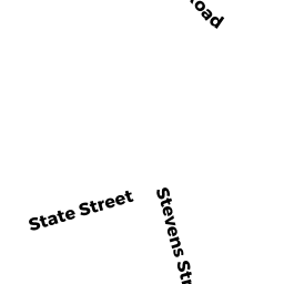
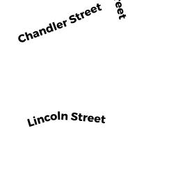
222 BOLTON ST
Owner Information
MANSA LLC
222 BOLTON ST
MARLBOROUGH, MA 01752


Property Details
222 BOLTON ST is classified as a Proffesional Building (Mixed use off/apt).
The primary structure on this property was built in 1845. There are 7,291ft2 of built area within this property. There is 4,976ft2 of residential/living space within this property.
222 BOLTON ST is valued at $555,200. The land is valued at $241,400 and the structures are valued at $288,600. There is an additional valuation of $25,200 on this property.
This property is in Zone A3. Confirm with local Zoning Board authorities to ensure there are no overlays or other easements on this property.
The most recent deed for 222 BOLTON ST is recorded at the local registrar in Book 53162, Page 025. 222 BOLTON ST was last sold on Wednesday, July 8, 2009 for $675,000.
Assessment data from fiscal year 2021.
Flood Data
According to the FEMA National Flood Hazard Layer, this property does not appear to be in a flood zone. It may also be in an area not yet reviewed. Nonetheless, confirm this information prior to taking any action.
To view the flood hazards around this property, create a FEMA "Firmette" Map of the area around 222 BOLTON ST.
Broadband Internet Providers
| Provider | Type | Bandwidth (mbps) | |
|---|---|---|---|
| VSAT Systems, LLC. | Satellite | 2 | 1 |
| Crown Castle Fiber | Fiber | 0 | 0 |
| Viasat Inc | Satellite | 100 | 3 |
| Verizon New England Inc. | DSL | 10 | 1 |
| Verizon New England Inc. | Fiber | 940 | 880 |
| Comcast | Cable | 1000 | 35 |
| GCI Communication Corp. | Satellite | 0 | 0 |
| HughesNet | Satellite | 25 | 3 |
Broadband service provider data from December 2020.
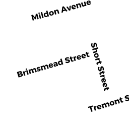
Adjacent Properties
- 236 BOLTON ST
Two-Family Residential owned by NAVIN SEAN A - 208 BOLTON ST
Single Family Residential owned by ROSSI MICHAEL PAUL - 237 PROSPECT ST
Single Family Residential owned by MULCAHY BERONICA M - 235 PROSPECT ST
Single Family Residential owned by MCCARTHY DANIEL J - 223 PROSPECT ST
Single Family Residential owned by EDELMAN ANN I LI EST - 192 BOLTON ST #5
Residential Condominium owned by BAENA JUAN M - 192 BOLTON ST #6
Residential Condominium owned by AGUILAR JOSE - 192 BOLTON ST #7
Residential Condominium owned by WINSKE ERNEST J TR - 192 BOLTON ST #8
Residential Condominium owned by LEWIS DEAN - 192 BOLTON ST #9
Residential Condominium owned by RANADE SHREEKAR - 202 BOLTON ST #210
Residential Condominium owned by ROONEY ELIZABETH J - 190-206 BOLTON ST
Other, Open Space owned by None - 204 BOLTON ST #10
Residential Condominium owned by DE NASCIMENTO JOSE - 204 BOLTON ST #11
Residential Condominium owned by WINSKE ERNEST J JR TR - 204 BOLTON ST #12
Residential Condominium owned by BAHMAD RENDE - 204 BOLTON ST #1
Residential Condominium owned by DAROSA MARIA RENATA F - 204 BOLTON ST #3
Residential Condominium owned by PANO LESLIE E - 204 BOLTON ST #4
Residential Condominium owned by OLSON SUSAN A - 204 BOLTON ST #5
Residential Condominium owned by WINSKE ERNEST J JR TR - 204 BOLTON ST #6
Residential Condominium owned by QUEZADA SERGIO - 204 BOLTON ST #7
Residential Condominium owned by DEALMEIDA WILLIAM ARCE - 204 BOLTON ST #8
Residential Condominium owned by DALLAMORA JOSEPH W TR - 204 BOLTON ST #9
Residential Condominium owned by VALIENTE MARIA E - 206 BOLTON ST #10
Residential Condominium owned by BALASUBRAMANIAN GOPINATH - 206 BOLTON ST #11
Residential Condominium owned by GUIOTTI KAMYLLA V - 206 BOLTON ST #12
Residential Condominium owned by BONILLA VICENTE - 206 BOLTON ST #1
Residential Condominium owned by PATEL APURVAKUMAR TR - 206 BOLTON ST #2
Residential Condominium owned by ENRIQUEZ AROLDO - 206 BOLTON ST #3
Residential Condominium owned by TAVARES FERNANDA - 206 BOLTON ST #5
Residential Condominium owned by FILHO JOAQUIM NASCIMENTO - 206 BOLTON ST #6
Residential Condominium owned by BUDAK MESUT - 206 BOLTON ST #7
Residential Condominium owned by DO NASCIMENTO ELIO - 206 BOLTON ST #8
Residential Condominium owned by YOUNG TIMOTHY A - 206 BOLTON ST #9
Residential Condominium owned by GONCALVES JOSE NATAL - 190 BOLTON ST #11
Residential Condominium owned by VIEIRA JOAQUIM ADECIL - 190 BOLTON ST #12
Residential Condominium owned by E&M RENTAL PROPERTIES LLC - 190 BOLTON ST #1
Residential Condominium owned by RAPONI FRANCO - 190 BOLTON ST #2
Residential Condominium owned by MENEZES MARCELO - 190 BOLTON ST #3
Residential Condominium owned by MA TIESONG - 190 BOLTON ST #4
Residential Condominium owned by PANO LESLIE E - 190 BOLTON ST #5
Residential Condominium owned by BOYKINS DION L - 190 BOLTON ST #6
Residential Condominium owned by MILLIAN ROBERT P JR - 190 BOLTON ST #7
Residential Condominium owned by ZHAO OUFEI - 190 BOLTON ST #8
Residential Condominium owned by E&M RENTAL PROPERTIES LLC - 190 BOLTON ST #9
Residential Condominium owned by MARCOLINO CARLOS FERNANDO - 192 BOLTON ST #10
Residential Condominium owned by TAVAREZ FERNANDA - 192 BOLTON ST #12
Residential Condominium owned by OLIVEIRA FLAVIANO L - 192 BOLTON ST #1
Residential Condominium owned by BURLEY MATTHEW J - 192 BOLTON ST #2
Residential Condominium owned by MENEZES FABIANA F - 192 BOLTON ST #3
Residential Condominium owned by TREMBLAY ROBERT J - 192 BOLTON ST #4
Residential Condominium owned by DASILVA ISRAEL - 204 BOLTON ST #2
Residential Condominium owned by PAGE T MICHAEL TR - 206 BOLTON ST #4
Residential Condominium owned by HENDERSON WILLIAM A - 190 BOLTON ST #10
Residential Condominium owned by MA TIESONG - 192 BOLTON ST #11
Residential Condominium owned by AGIREDDY RAJA - 225 PROSPECT ST
Single Family Residential owned by XENOS ARTHUR J